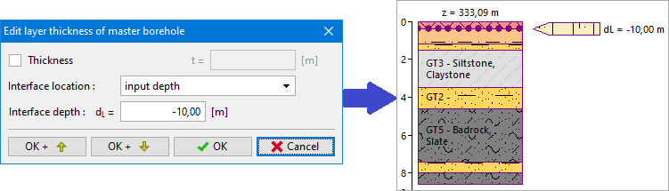
Input Depth of Interface Location
- input depth of interface - the depth of fictive lower interface of the layer is entered - the interface is generated in defined depth. The depth is measured as a distance from the top of the borehole on the terrain, positive values downward to soil body, negative upward above the terrain.
In the picture, we see the edit of layers above the borehole using input of distance dL from the top of the borehole.
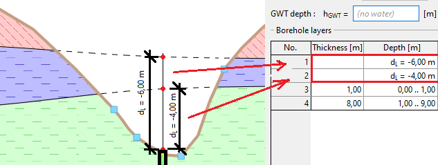
This way of input is used when modeling soil lenses. Using input of interface point above the terrain or deeply to the soil body, we ensure the correct generation of soil lense interface.